
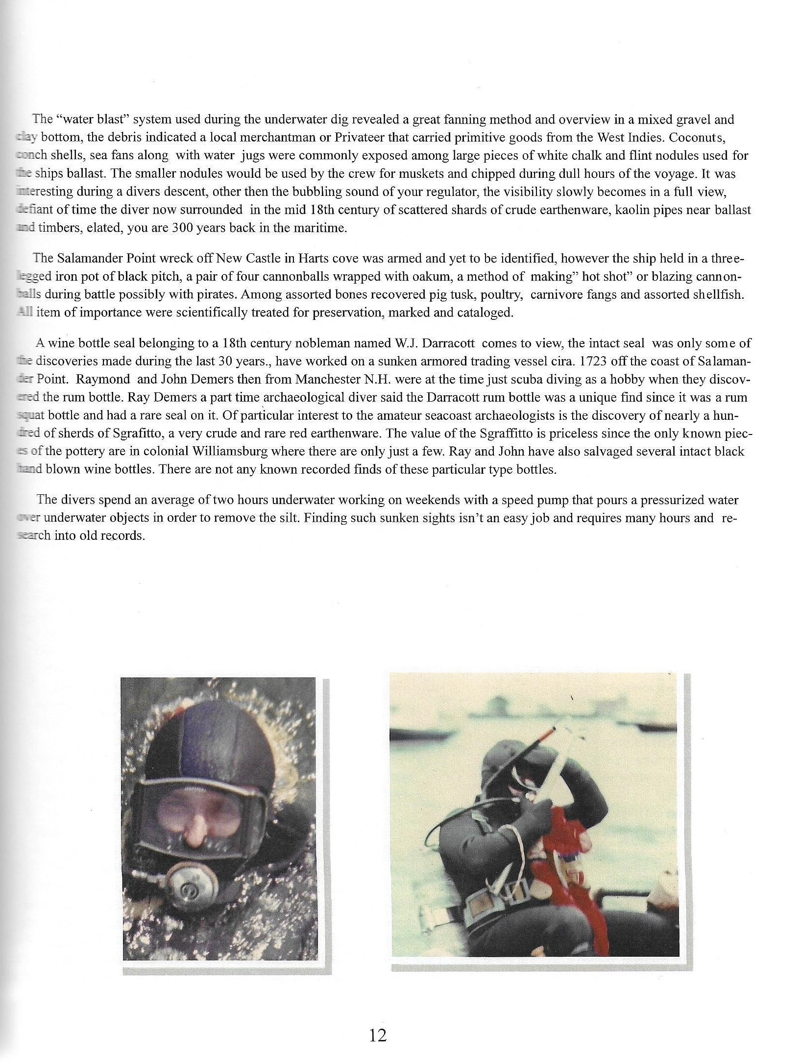
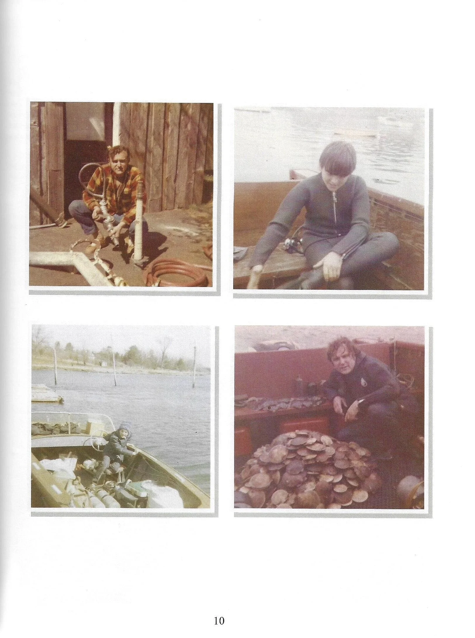
Obsession WIth The uknown
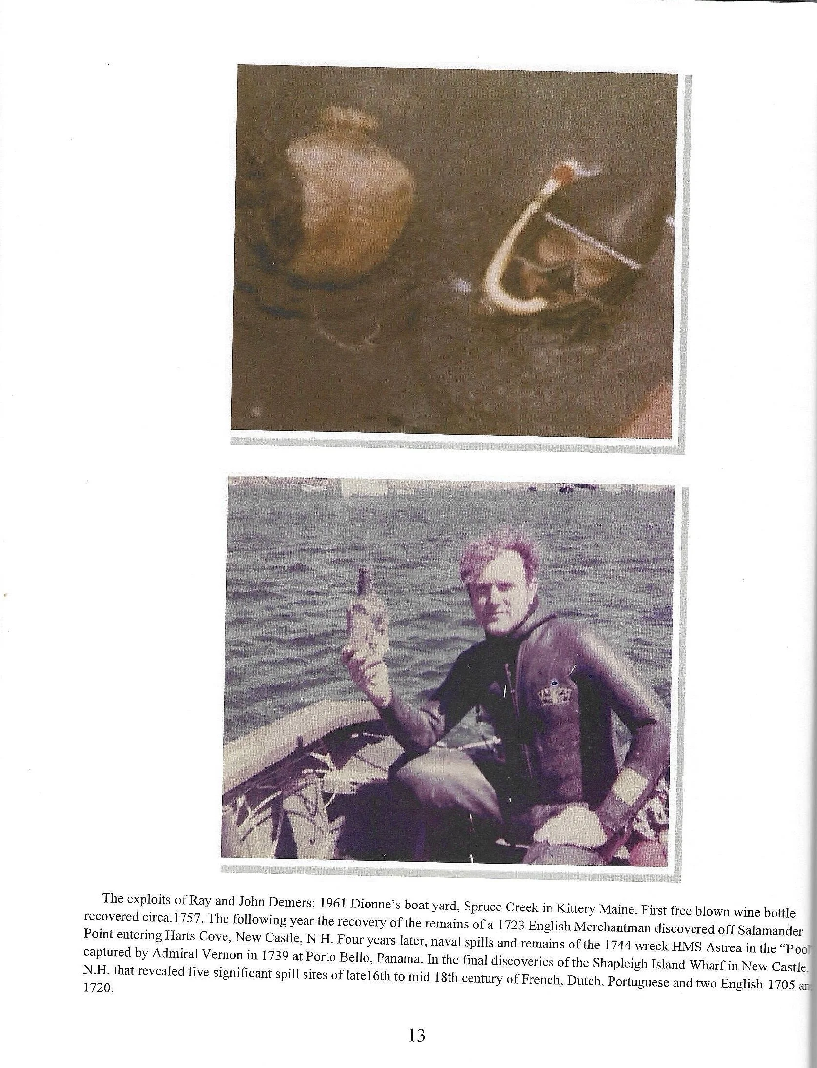
The father and son dive team
INTRODUCTION
The Province of New Hampshire is a name first given in 1629 to the territory between Merrimack and Piscataqua River on the eastern coast of North America. It was formally organized as an English royal colony on October 7, 1691, during the period of English colonization. The charter was enacted May 14,1692, by William and Mary, the joint monarchs of England and Scotland, at same time that the Province of Massachusetts Bay was created. The territory is now the U.S. state of New Hampshire in southern England by Captain John Mason, its first proprietor.
First settled in the 1620s, the province consisted of a small number of communities along the seacoast and the Piscataqua River. (from Wikipedia, the free encyclopedia).
During the period of the European expansion, the Piscataqua River settlements at the turn of the 17th century were being embarked by the French, Dutch Portuguese fisherman and Eng-lish. Europe was much in need for economic development and wanting to gain insight to harvesting associated raw material, beaver pelts is one economic driver to make felt hats along with other furs were exported, rum merchants were also trading for hand crafted goods from the Carib-bean.
Beside the Portsmouth Harbor docks, it was common that along the Piscataqua River Harbor many tributaries provided wharfs and anchorage for smaller vessels to replenish food and water perform ship repairs and transfer cargo.
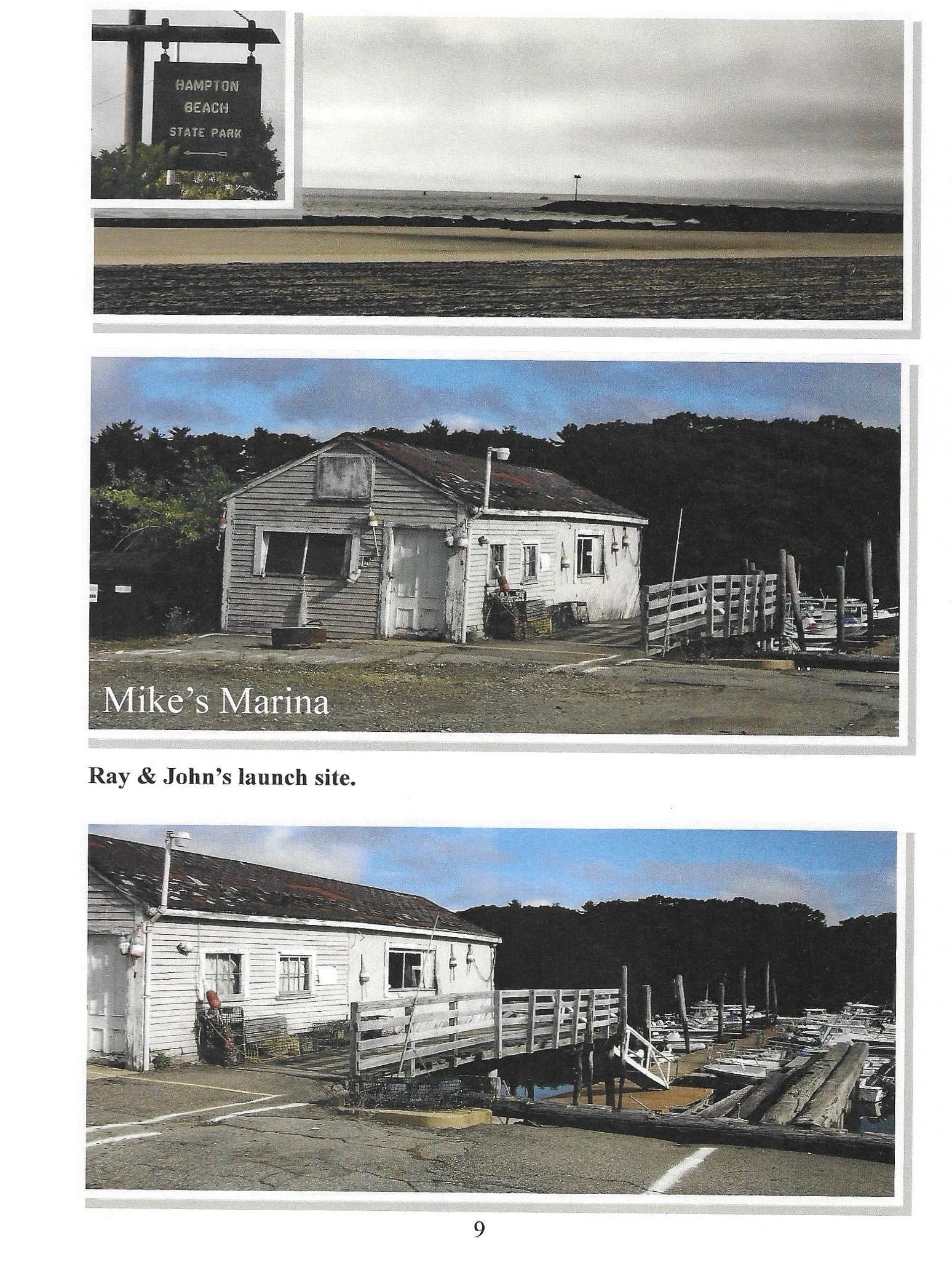
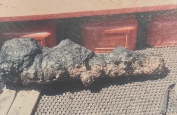
As seasoned bottle hunters the divers were well aware of identifying glass sherds from early wine, or rum bottles, all sites during grid surveys would necessitate mapping and plotting for future reference and research. A perfect example of opportunity was the discovery of a single upright intact shaft and ball wine bottle void of her content's in the mid channel of the "Pool" facing away from the Shapleigh Island bridge to Goat Island, although only speculative at the time the divers immediately suspected a docking site for early ships, further studies revealed an interesting underwater topography in its primitive state covered with intrusive litter. Over the following dive seasons provided an amazing exploration that required years to research.
Perhaps one of the oldest sites along the Piscataqua Harbor, the Shapleigh Island Wharf will forever be known as a unique 17th century discovery
Since the Indians discovered the great river, it was perceived by them as three rivers flow-ing into one and named it "Piscataqua".
An explorer, Captain John Smith in 1614 was commissioned by London Merchants to sail to a new Frontier to map many of the coastal river inlets and navigate in the river channels of the New World, on arrival the Captain formed eight of his crew in a small craft to navigate deep into the hinterland. According to his notes he sailed 15 to 25 miles up several tributaries that flowed into the main river. The exploration was impressive, tall timbers could be used for mast and ship building, he also noted safe anchorage sites situated near the fishing grounds of the Atlantic. On his return to England his discovery greatly inspired his countrymen to settle in the new frontier.
In the following decade, villages began to develop in the region, settlers begin to construct homes for there families, others with ship construction knowledge taken back from their mother country, would construct smaller sailing ships in the 30 to 50 ton class, many of the ships were used in the West Indian molasses trade.
The swirling tidal water of the Piscataqua River was very turbulent and held in great respect by the early sea captains. The incoming eight to ten foot tide merged against the inland tributaries that change to outgoing tides created a push-or-be pulled effect up to six knots, strongest during the spring ebb in the narrows above Portsmouth and at the 400 yard gap between Pierce's and Seavey Island.
In 1623, the Thompson family was the first to settle "Pannaway", now called Odiorne Point located in the town of Rye. The new fishing settlement operated in a small bay, which they named " Little Harbor," a shoal inlet south of the Great Island ( Newcastle Island) and considered a coastal inlet of the Piscataqua region. In 1629, King Charles I| gave John Mason the largest grant in the region, later the land was called "New Hampshire" after his native"Hampshire" county in England. (author unknown).
At the northeasterly entrance to the Piscataqua River along Kittery Maine, Pepperell Cove to Spruce Creek has a combination of anchorage and launching sites. At the rivers main entrance to New Hampshire Great Island light house at fort Point across from Kittery, Maine offered to an incoming vessel a safe quarter mile berth and depth of 30' to 60.'
The Western ledges and smaller islands off Newcastle that border the main river channel, since the early 19th century has been interconnected by two bridges and causeway built from Portsmouth NH to Shapleigh Is. to Goat Is. and causeway to Newcastle Island. These facts are geography's gift to explore.
The Piscataqua River offered a natural waterway to the region, priceless to the economic and prosperity of the surrounding communities in both New Hampshire and Maine. Such is its rich and varied history
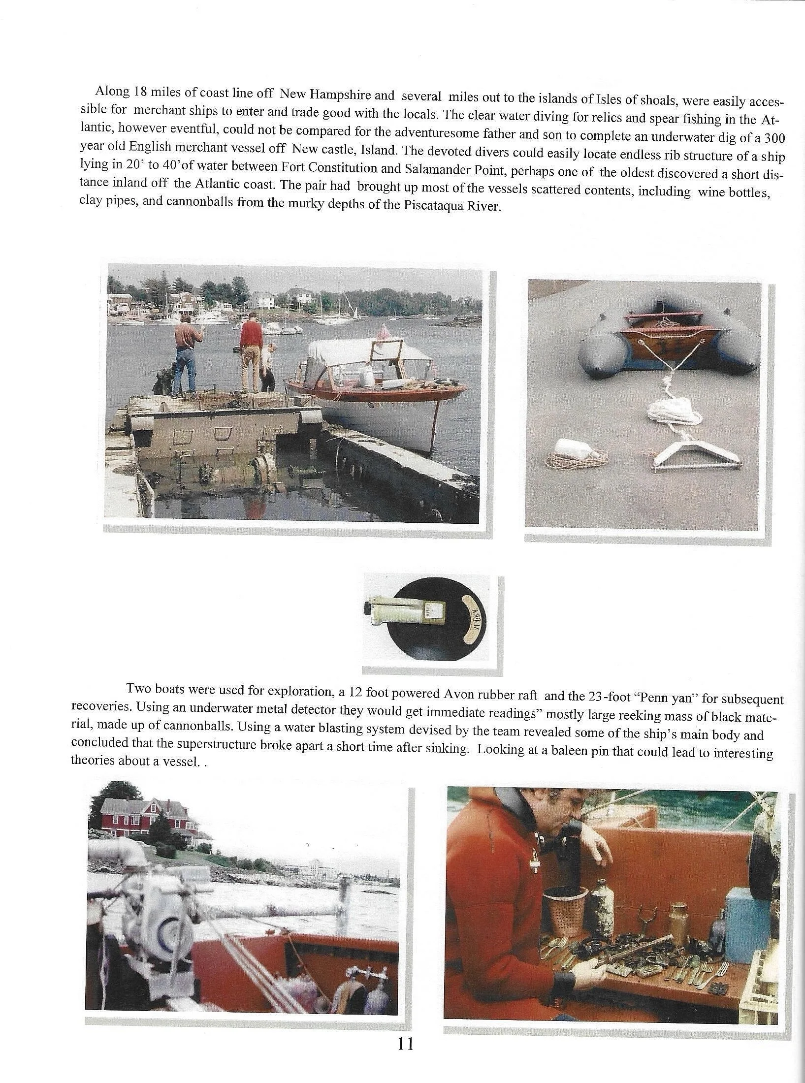
The dive team consisted of Master divers and experienced seaman well informed in the study of antiquity, shipwrecks and state regulations in the tidal waters of New Hampshire. The team was freelance, not affiliated with any organization or subsidized by private funds. The divers objective was to undertake an exploration in the Portsmouth harbor doing a grid search along the Piscataqua river headlands that border New Hampshire.
In the advent of SCUBA, "Self Contained Underwater Breathing Apparatus," advanced worldwide the pace of new underwater discoveries, the new technology aroused man's further curiosity of the unknown in search not only for treasure but apply an interest in remote underwater sites that by nature and cultural changes have lost the archaeological value of the "time laden cap-sule" leaving only scattered relics from past history.
As "web footed historians" called by his pundits, the amateur diver is the one who will explore ancient harbors along challenging waterways that were used on occasion by the early Merchantman as refuse bins leaving relics not necessarily of monetary value but to reveal one of a kind object or event that could construe a wealth of information for the experts in archeological digs.
Driven by curiosity, the dive team had an opportunity to view and scientifically search an ancient river bottom following along the different trade routes taken by early Merchant ship's entering Portsmouth harbor. The study would begin from the headlands to the outer ledges of the bedrock leading the divers to kelp and down a muddy and silted slope to a deeper sandy gravel bottom, in working depths from 15' to 50' a grid search could reveal remains of wrecks or early spills during the maritime. Limited to time, tide and water depth the divers goal was first to concentrate in locating "staging and mooring sites" off the New Hampshire shoreline in the deeper sections of water to recover numerous 16th to late 18th century spills for interpretation.
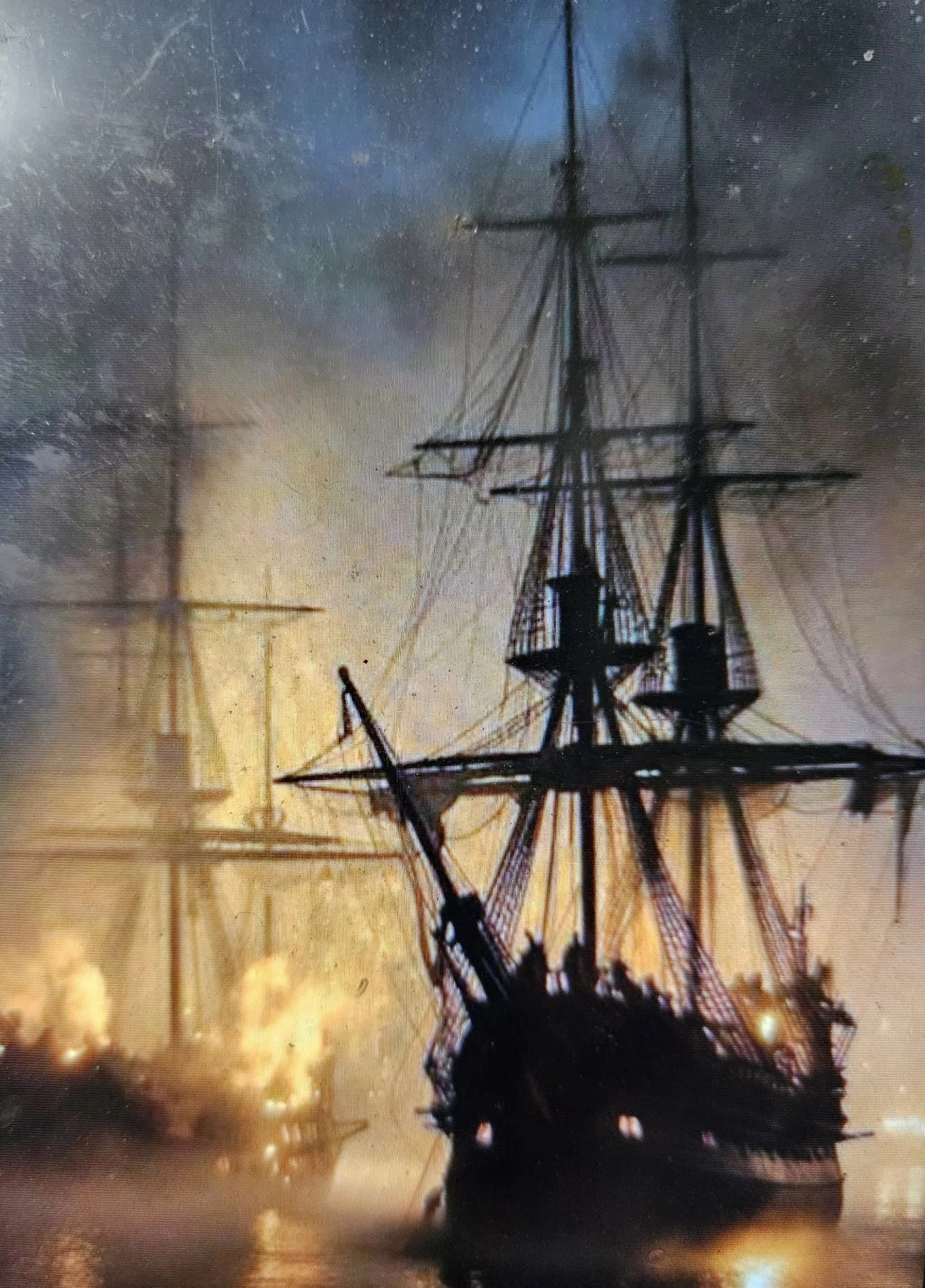
From the mouth of the tidal water of the Atlantic to the Piscataqua river into Great bay extends approximately 145 miles into the hinterland of which border the state of New Hampshire. In the colonization of the first several inland of the harbor were the most vivacious, new settlements flourished along the shores, ships were rapidly being built, the French and Dutch merchant were the first to trade with the colonist, Portuguese fishing fleets seeking shelter from the ferocious northeast storms would anchor in the harbor that offered refuge, armed privateers would often enter the harbor with goods from the West Indies having traded slaves for rum, spices, tobacco, salt, molasses and tea. Schooners, with shallow draft Sloop and Ketch were the most popular design of ship, other variations of style were noted, however the local ship builders not having time or a large variety of wood for repairs usually maintained similar ship design features taken from their mother country.
In most instances a ship from 30 to 500 ton required a pilot, he would assist in coordinating a passageway inside the turbulent water of the Piscataqua, any miscalculation in time or tide couldcould easily in the currents lead to a lost of ship. Comprehending the Piscataqua river system by the locals was essential, any ship including a round bottom was with extreme caution, its tide could lead to a loss of ship. Comprehending the river system was essential ,the smaller coastal ships had a shallow draft and built with a round bottom. More prone to beech the ship could be allowed to sail close to shore. It was not uncommon to see crews jettison heavy ballast including cannons to lighten a ship that had run aground.
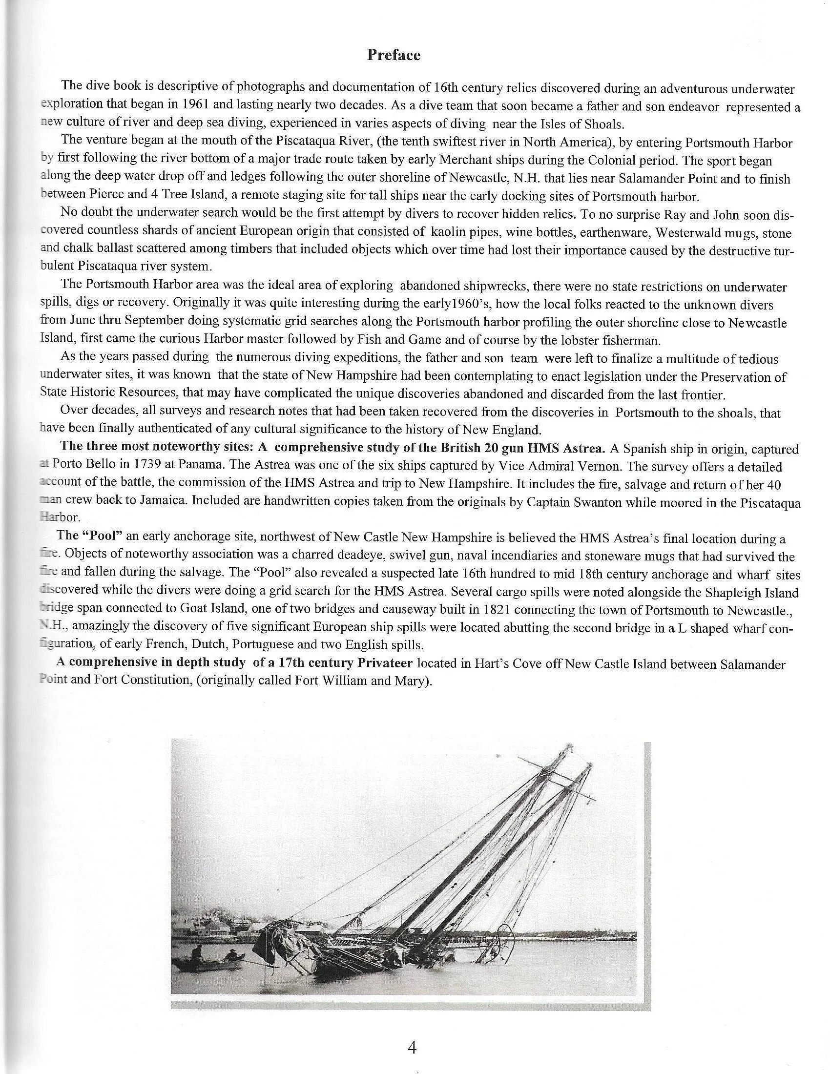
The river survey required many grid searches for the divers, inquiries to local lobsterman about raised anchors or bottom structure that may have interfered with fishing gear, historical maps were reviewed providing descriptive clues to potential wrecks, several publications one in particular " Ports of Piscataqua" noted Vernon's HMS Astrea in 1744 that burned in the "Pool", the information expedited further research to the Public Office in Kew, England, requesting any factual records of a ship named "Astrea" and to forward a private researches listing to contract. The "Pool " in itself presented an extensive study not only locating limited remains of the Astrea, but lead to the discovery of a suspected wharf off Shapleigh's Island perhaps one of the earliest in Portsmouth harbor that contained five separate spills of European origin dating from the late 16th century to the turn of the 18th century. A third ship the "Wonolanset" that caught fire in 1811, while tied alongside Shapley's wharf attempts were made to scuttle and sink the ship, she was cast off and drifted on some rocks where hull and cargo where entirely consumed.
In consideration of the geographic outline of Portsmouth Harbor, transit routes taken by the tall ships entering from the coast had to be known by the divers, the most susceptible area for spills would have been in staging or mooring sites. It was not uncommon to take days or weeks prior to being moored in either Maine or New Hampshire allowing the crew an opportunity to clean ship.
On occasion the ships pilot taking in consideration time, tide and mooring availability would relocate to a second deep water staging site in the Piscataqua river between 4 tree Island and Pierce Island that allowed additional time to be moored in the "Pool" or the Portsmouthk docks to transfer cargo.
The New Hampshire deep water survey would restrict a divers grid search only at low tide to 30 minutes between tides every 6 hours, during tide changes divers were relocated to begin a new grid in shallower and moderate currents closer to shore nearest to mooring sites. Any interpretation of a suspected site without knowing the provenance required diligent research with expert identifi-cation. Plotting mapping and photographing all recovered objects along with their association could establish dating and nationality on most 17th to 18th century site within 25 years.